
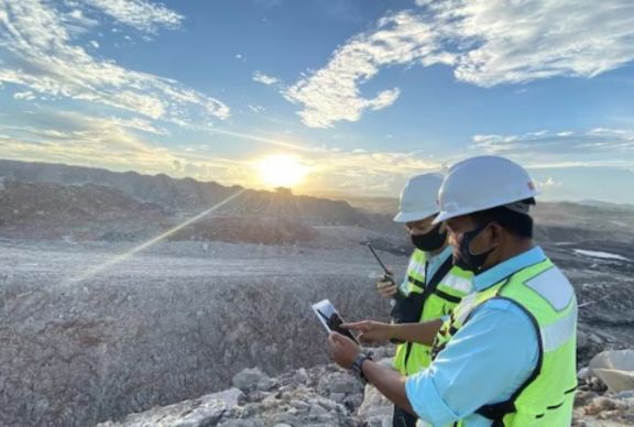
Ground-based survey methods have been the default on mining operations for decades. They work, they’re familiar, and most site teams know how to manage them. But familiarity isn’t the same as optimal, and a growing number of operations across Western Australia are quietly shifting their approach after doing the maths on risk, data quality and crew productivity.
The switch to UAV-led data collection isn’t happening because someone read a brochure. It’s happening because the outcomes are measurable and the case is difficult to dismiss.
The Risk Exposure That Gets Normalised Over Time
One of the more uncomfortable realities on active mine sites is how quickly hazardous tasks become routine. Personnel walking haul roads alongside heavy plant, standing at pit crests to capture highwall data, or entering recently blasted areas ahead of formal clearance. These tasks happen constantly, and because incidents don’t occur every time, the risk starts to feel manageable.
It isn’t. It’s just inconsistent.
UAV surveys remove personnel from those positions entirely. The drone flies the hazardous area. The surveyor operates from a safe standoff distance. The data collected is comparable in accuracy and often superior in coverage to what a ground crew would produce under the same conditions. For any experienced land surveyor Perth working across resource projects, that shift in exposure profile matters.
The Data Holds Up
A common reservation from operations teams is whether UAV-derived data is actually reliable enough for production decision-making. It’s a fair question, and the answer is yes, provided the survey is planned and executed by qualified personnel using appropriate ground control.
UAV photogrammetry and LiDAR outputs used by Perth surveyor teams on mine sites routinely deliver:
- Stockpile volumes within 1-3% of ground-truth measurements
- Digital terrain models accurate to within 50mm vertically on stable ground
- Pit floor and bench mapping at resolutions ground crews can’t practically replicate
- Post-blast muck pile data collected before ground entry is approved
That last point matters operationally. Production teams get the fragmentation and volume data they need faster, re-entry decisions are better informed, and the dig sequence planning starts sooner. The data isn’t just safe to collect. It’s genuinely useful.
Productivity That Compounds Across a Roster
Ground-based stockpile surveys on large operations can tie up crews for the better part of a shift. Multiple stockpiles, access routes, safety escorts, and the physical demands of working on unstable material all add time. The licensed surveyors in Perth report that UAV-based stockpile programs covering the same inventory take a fraction of the time.
That time difference compounds. Faster survey cycles mean more frequent data, which means production and planning teams are working from current numbers rather than figures that are days or weeks old. On sites where material is moving constantly, that currency of data has genuine operational value.
What Sites Running Purely Ground-Based Methods Should Be Asking
If your operation still relies entirely on ground crews for pit monitoring, stockpile measurement and post-blast assessment, there are some practical questions worth putting to your survey and safety teams:
- How many times per month do personnel enter areas classified as high-risk to collect survey data?
- What is the lag between a blast event and when production teams receive usable survey outputs?
- Are highwall inspections happening as frequently as geotechnical risk warrants, or is access difficulty limiting the schedule?
- Could the same data be collected with personnel in safer positions?
Property surveyors Perth resource operations engage are increasingly being asked these questions during mobilisation planning, not as an afterthought. The sites that ask them early tend to build better workflows.
Where UAV Surveys Fit Within a Broader Program
UAV data collection works best as part of an integrated survey program, not as a standalone replacement for all ground-based work. There are tasks that still require physical access and direct observation. Control network establishment, legal boundary definition and certain geotechnical monitoring applications all need boots on the ground at some point.
What UAV capability does is remove personnel from the high-frequency, high-exposure tasks that don’t actually require physical presence. The Subdivision surveyors Perth use similar logic when structuring survey programs around rehabilitation monitoring, where UAV coverage across large disturbed areas replaces time-consuming and physically demanding ground transects.
The Site survey Perth programs that integrate UAV and ground-based methods intelligently tend to produce better data coverage, lower incident exposure and more consistent reporting cycles than programs that rely on one method alone.
Final Thoughts
The operations that have made this shift aren’t looking back. The risk reduction is documented, the data quality is defensible, and the productivity argument makes itself. If your site is still asking whether UAV surveys are worth it, the more relevant question is how much longer the current approach is worth holding onto.


